


Springdale Twp. Voting District, Redwood County, Minnesota
About
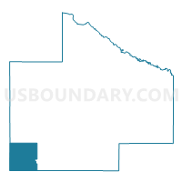
Outline

Summary
| Unique Area Identifier | 603990 |
| Name | Springdale Twp. Voting District |
| County | Redwood County |
| State | Minnesota |
| Area (square miles) | 35.86 |
| Land Area (square miles) | 35.78 |
| Water Area (square miles) | 0.07 |
| % of Land Area | 99.80 |
| % of Water Area | 0.20 |
| Latitude of the Internal Point | 44.23992100 |
| Longtitude of the Internal Point | -95.53549330 |
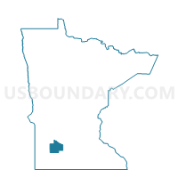
Maps

Graphs
Select a template below for downloading or customizing gragh for Springdale Twp. Voting District, Redwood County, Minnesota


Neighbors
Neighoring Voting District (by Name) Neighboring Voting District on the Map
- Amiret Twp. Voting District, Lyon County, MN
- Gales Twp. Voting District, Redwood County, MN
- Holly Twp. Voting District, Murray County, MN
- Johnsonville Twp. Voting District, Redwood County, MN
- Monroe Twp. Voting District, Lyon County, MN
- North Hero Twp. Voting District, Redwood County, MN
- Shetek Twp. Voting District, Murray County, MN
- Tracy Voting District, Lyon County, MN
- Walnut Grove Voting District, Redwood County, MN
Top 10 Neighboring County Subdivision (by Population) Neighboring County Subdivision on the Map
- Tracy city, Lyon County, MN (2,163)
- Walnut Grove city, Redwood County, MN (871)
- Shetek township, Murray County, MN (296)
- Amiret township, Lyon County, MN (245)
- Springdale township, Redwood County, MN (217)
- Monroe township, Lyon County, MN (202)
- North Hero township, Redwood County, MN (161)
- Johnsonville township, Redwood County, MN (152)
- Gales township, Redwood County, MN (137)
- Holly township, Murray County, MN (127)
Top 10 Neighboring Place (by Population) Neighboring Place on the Map
Top 10 Neighboring Unified School District (by Population) Neighboring Unified School District on the Map
Top 10 Neighboring State Legislative District Lower Chamber (by Population) Neighboring State Legislative District Lower Chamber on the Map
- State House District 21A, MN (36,793)
- State House District 21B, MN (35,392)
- State House District 22A, MN (34,781)
Top 10 Neighboring State Legislative District Upper Chamber (by Population) Neighboring State Legislative District Upper Chamber on the Map
Top 10 Neighboring 111th Congressional District (by Population) Neighboring 111th Congressional District on the Map
Top 10 Neighboring Census Tract (by Population) Neighboring Census Tract on the Map
- Census Tract 7505, Redwood County, MN (2,946)
- Census Tract 3606, Lyon County, MN (2,933)
- Census Tract 3607, Lyon County, MN (2,134)
- Census Tract 9001, Murray County, MN (2,119)
- Census Tract 7506, Redwood County, MN (1,800)